NZDA Research Fund Project: Molesworth Ungulate Relative Abundance Survey Pilot
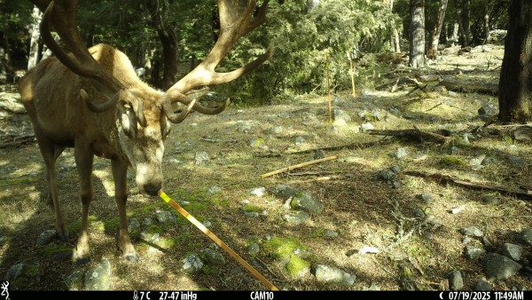
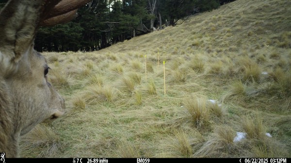
Photo Credit: DOC Static Camera Survey Project – South Island High Country Station (marker pegs are used for distance scale) – T Moore, DOC, 2025
The New Zealand Deerstalkers Association is pleased to support a new, hunter-led research project aimed at improving how ungulate populations are understood and managed in one of New Zealand’s most significant hunting areas.
The Molesworth Ungulate Relative Abundance Survey Pilot is being led by NZDA Marlborough Branch, with support from NZDA Nelson Branch, and has been approved for funding through the NZDA Research Fund.
Why Molesworth matters
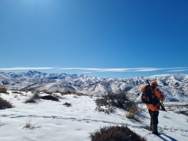
At over 180,000 hectares, Molesworth Station is one of New Zealand’s largest land areas, comparable in size to Rakiura / Stewart Island. Legally designated as a Recreational Park, it is publicly owned and administered by the Department of Conservation (DOC), while farming operations (cattle only) are leased by Pāmu.
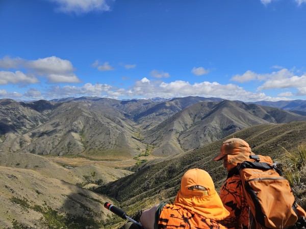
Molesworth is often described as “New Zealand’s biggest farm”, but it is also a highly valued public hunting area. Each year, between 750 and 1,000 hunters are named on permits to hunt within designated areas of the station. The park is well known for quality red deer hunting, with chamois and feral pigs also present.
For the past two decades, much of Molesworth has operated as a restricted hunting area, requiring careful balancing of recreational hunting, conservation values, and farming interests.
The challenge: managing without good data
Local NZDA branches, led by Marlborough, have long supported active and responsible game animal management within Molesworth. Recent examples include a DOC-supported goat control operation coordinated by Marlborough NZDA, which removed more than 1,000 goats and 70 pigs in just four days.
However, concerns have also been raised at times about deer numbers from a farming perspective. In response, significant removals - largely outside of recreational hunting blocks and often undertaken by helicopter have occurred.
From NZDA’s perspective, these responses have not always been well supported by consistent long term evidence. Ad hoc or reactive management risks undermining hunting opportunities and public confidence while failing to deliver durable outcomes.
Looking ahead, better information on ungulate abundance and trends is essential.
Why relative abundance surveys?
Over recent years, NZDA has explored a wide range of possible monitoring tools, including DNA sampling, helicopter or drone counts, and ground-based human surveys. Each has limitations in terms of cost, repeatability, scale, or long-term feasibility.
DOC has recently begun trialling a standardised, fixed-camera methodology for monitoring ungulate relative abundance across several regions of New Zealand, building on successful use overseas.
Importantly, relative abundance focuses on trends and changes over time, rather than attempting to calculate absolute animal numbers - an approach that is more realistic, cost-effective, and informative for long-term management.
This methodology:
-
Is comparatively low cost over time
-
Is repeatable and scientifically robust
-
Can be applied consistently across large landscapes
-
Produces data that is comparable with DOC datasets elsewhere
DOC staff, including experienced animal monitoring specialists, are providing technical guidance to ensure the project is set up correctly from the outset - support that significantly reduces risk and improves credibility.
What the pilot involves
The pilot will deploy motion-activated static cameras in selected hunting blocks within Molesworth, arranged in structured “arrays” of six to eight cameras, spaced according to a strict methodology.
Data captured will include any four-legged animals of size moving through the area. Images and video will be analysed using freely available software, with DOC providing guidance on data handling and interpretation.
Over time, this growing image library may also support future AI-assisted analysis, potentially enabling improved insights such as demographic trends and individual animal re-detection.
Where appropriate, camera servicing trips may also include complementary ground-based data collection, such as optical observations, thermal imaging, and scat counts.
Project phases and timeline
The project is structured in three phases:
-
Phase 1 – Initial pilot (2026)
Two camera arrays deployed for 3–6 months to confirm camera reliability, placement, and data quality. -
Phase 2 – Expanded pilot (2026)
Expansion to three or four camera arrays, using up to 30 cameras. Progression is dependent on Phase 1 results. -
Phase 3 – Future programme (subject to success)
If the pilot proves effective, the project may transition into an ongoing, hunter-led ungulate monitoring programme for Molesworth from 2027.
The pilot is expected to conclude in early 2027, with regular reporting to NZDA throughout.
NZDA Research Fund support
NZDA has approved $14,300 (+ GST) from the Research Fund, provided in two tranches aligned with Phases 1 and 2. Funding supports camera equipment, mounting hardware, batteries, travel, and essential project costs.
As part of the agreement, Marlborough NZDA will provide progress updates, field imagery, and a feature article for Hunting & Wildlife magazine during the life of the project.
A long-game investment in better management
This project reflects a long-term commitment to evidence-based game animal management in one of New Zealand’s most important hunting areas.
As project leaders have noted, this is the kind of work many wish had begun a decade ago. Starting now is far better than continuing to manage without reliable data.
If successful, the approach trialled at Molesworth could be applied elsewhere, providing local NZDA branches with a practical tool to understand population trends and support informed, balanced management decisions on public land.
Updates will be shared as the project progresses.